Tuesday, September 14, 2010

Windy, Windy, Windy

KINGFISHER

Synopsis - We are currently in Northport Michigan at the town marina. The last two weeks have been quite windy on the lake Michigan with waves up to 14 feet. We have been travelling when there is a break but mostly hiding out in various harbors. Winds were low this morning (on the 15th) so we travelled to Northport to store the boat for the winter. We will either come back next year to do more cruising here or sell the boat. We should be home around the end of October after doing some maintenance. A summary of the trip so far is as follows:
  • 199 days since leaving Kirkland
  • 125 days since leaving St Pete Florida
  • 3700 miles driving to Florida
  • 3100 miles in the boat
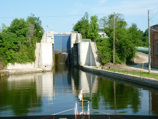
  • 84 locks
  • Nine states plus Canada


After leaving Canada and clearing customs , we went to the small town of De Tour
Michigan. The marina was right on the shipping lane for freighters carrying ore and other cargo to US and foreign destinations. They go by frequently so it is quite a show.
Here is a picture of one so you can see these are BIG ships.


On labor day, the wind dropped so we left DeTour for the run across the Mackinaw Straits. It was over 40 miles of open water so we were glad to get to Mackinaw City to a protected marina where we could wait out the next three days of high winds. Sustained winds of 40 mph and gusts to 60 mph along with waves up to 14 feet were reported. These conditions are impossible for any recreational boat. Mackinaw City has a lot of history and is at the Southern end of the Bridge that connects lower Michigan to the "Upper Peninsula". Here is some of what we have learned about Michigan-
  • If you live north of the bridge (i.e. on the Upper Peninsula), you are a Yooper. Yoopers have a dialect that is unique to that area and sounds a lot like French Canadian. ("So you're going under da bridge eh?")
  • If you live south of the bridge (i.e. on the main part of Michigan), the Yoopers call you a troll or a fudgie. Fudge seems to be a dietary staple around here, at least for tourists. So far I have only bought two and a half pounds.
  • One lane of the bridge is closed off every Labor day and it's traditional to take the five mile walk across it. Even the governor does it. We didn't.
  • The Mackinaw Straits have been the crossroads of the whole Great Lakes Mid-West area for thousands of years. First, the Indians gathered here in the summer to fish and re-strengthen clan ties. Then it was the center of the fur trade in the 1700s and 1800s. Now, all of the shipping to and from Lake Superior and Lake Michigan go under the bridge.
  • Mackinac and Mackinaw are both pronounced the same -Awwww!

Here is a picture of Linda on the beach at Mackinaw City with the bridge in the background. Pretty long eh?


We did boat chores, did a little sight seeing around Mack City and took a day trip over to Mackinac Island. It is famous for two things. First, there are no motorized vehicles allowed on the island, only bikes and horses (over 500). Second, is the Grand Hotel which has been serving tourists since the late 1800s. It has a porch that is the longest in the world and was the scene of a Christopher Reeves movie called "Somewhere In Time" (you remember that one boys - right?) that has developed a cult following. Here are pictures of the main street and me relaxing on the porch after a great buffet lunch waiting for my horse.


Next we went to the town of Charlevoix about 40 miles south of the bridge. It was a great town and there was lots to do within walking distance of the boat. Charlevoix is famous for it's "mushroom" houses that were built in the 1930s and look like something out of Snow White.

Linda and I decided that although we would like to cruise the Tenn Tom River system, we really did not want to go back to Florida. Once you start down the rivers, you are committed to end up in the gulf. It isn't the greatest cruising area for a boat like ours and it a bad market to sell a boat like ours. Also, we both miss home and look forward to seeing you all. So, we are storing the boat on the hard in a heated building in Northport and will deal with it in the Spring.

I figure that most of you aren't interested in hearing about the boat maintenance projects we will do over the next few weeks so this is the last posting of this blog. Hope you enjoyed it.


Bye from Tod and Linda.

See you soon.


Tuesday, August 31, 2010

September 1, 2010 - My Noodle Is Blue

Synopsis – We are in the town of "Blind River" on the North Channel of Lake Huron in Ontario Canada. We have traveled 2900 miles since leaving St Pete in early May. All is well and we have been cruising in stunning beauty for the last couple of weeks. We have been cruising generally northwest in "Georgian Bay" and then the "North Channel". It has become progressively more remote and progressively more beautiful. This is northern latitude island cruising at it's best.

Shortly after our last posting we went through one of the trickiest spots on the whole trip.

It is shown on the photo to the right but it is really MUCH scarier than it looks here. .

To negotiate this ROCKY area, you have to go to the right of the green buoy and then turn left IN FRONT of the rock with the red triangle on it and then around the rock. There were rocks within a few feet of either side of the boat so of course we had to go through at dead slow. After going through this area, we had to stay in an anchorage for three days because the winds were 20 to 30 mph out in the open water. This results in waves that are from three to six feet high and would be TERRIBLE to travel in. So, we just hunkered down for three days and watched the wind blow in the trees. Even here, we got a few TV stations that were local broadcasts.

We had a wide variety of weather from pretty nice (but windy) to rain, thunderstorms and fog as shown in this view. We were anchored off a main route and during this three days we saw almost no traffic. It was lonely.


A major portion of Canada is covered by huge granite formations that are collectively called "the shield". This is the dominating geological feature of the landscape in this cruising area so everywhere you look there are granite islands that have been scoured by glaciers with beautiful windblown trees and bushes. We have a million pictures of them but here are two.


When the winds dropped down some on August 18th, we headed to the big town of Killarney and tied up at the Killarney Mountain Lodge. Boy civilization felt good. They had a restaurant and everything! It is actually a cute little town and although the "store" is quite lame, it was great to be there for a couple of days. One of the town

landmarks is a fish and chips restaurant that is in an old red bus and serves lake trout and whitefish that are netted locally every morning. Here is a view of it and let me tell you they really pack them in at this time of the year (of course they are closed in the fall, winter and spring).

After Killarney, we continued on and went into a bay called "Baie Fine" (pronounced

Bay Fin) and anchored with quartz hills surrounding us. Here is a picture of the hill top we reached after hiking up about a mile. The "ground" here is all solid quartz. The views were incredible.


Here is a picture of Linda recovering after

we returned to the boat.


After a few days in Baie Fine, we went into the town of Little Current which is the only way to drive onto the island of Manitoulin (it's a huge island – look it up!). This is important geography around here and of course we had never heard of it. We were surprised to suddenly be in the middle of a bunch of cruisers that had gathered here, drawn by what is called the "cruiser's net". One of the townsmen (Roy Eaton) does a radio broadcast every morning on the VHF radio at 9:00 for boaters. He covers news (local, regional and international), local marine weather forecasts and has all of the boats that can hear him check in (typically

60-100 per day for the roughly 80 mile stretch that he tries to serve). He had also organized a pot luck dinner (with music and prizes from the local businesses) for the boats in Little Current so we met quite a few other cruisers and hooked up with some fellow "loopers" including these folks (Marty, Gloria, Don, Richard, Gill, Rhonda and Joey on three boats) who we had run into before on the Trent Severn Canal System and several times since. We had a great dinner and a nice visit.


There was also a couple that were cruising with SEVEN CHIHUAHUAS, some of which are shown here. Bet their boat smells good!

After leaving Little Current, we went to the small (itty bitty) town of Kagawong to view Bridal Falls and then moved on to anchor in an area called the Benjamins off Croker Island. The anchorage was nestled between granite hills and some evergreens clinging on for dear life. We stayed longer than we had planned to enjoy the perfect weather and check the area out a bit more. We did a lot of swimming (hence my purple noodle and Linda's blue noodle swim toys) and relaxing. We had calm winds and hot air and water temps.

Here is a picture showing Kingfisher in the anchorage however it doesn't due justice to the surrounding area and the granite hills.


Here is another picture taken from our boat across the anchorage showing the sailboat of Tom, Cheri and Cookie who live in Michigan but work at Park City Utah for the Winters. We shared dinners, dingy rides and swimming with them.


We continued West with a loose plan to reenter the USA right after Labor day and went into an anchorage called "Bear Drop". Again, it was granite cliffs around us and warm water. On the first day of September, we made our way to the town of Blind River to have a little "town time" and stay out of the forecast winds. After Labor Day we plan to spend a few days on Mackinaw Island and then head south on Lake Michigan.

That's all for now. The last month or so has been very pleasant and often more like a vacation than a journey. We miss you all and wish you well.

Have a great Labor Day holiday and we look forward to seeing most of you when we return in October or November after putting the boat away for the winter near Traverse City Michigan.

Tod and Linda C


Thursday, August 12, 2010

8/12/10 - Georgian Bay

Synopsis - We are in the very small town (village?) of Britt about half way up the Georgian Bay on Lake Huron. We have travelled a total of 2750 miles since leaving St Pete on May 10th, 2010. We have transited a total of 80 locks but don't think we will have any to go through any more in the foreseeable future. We now plan on
"storing" the boat in NE Lake Michigan for the winter so we will probably be home sometime in October or November.

Since our last blog, we finished going through the Trent Severn Waterway including all 45 locks. There is a variety of lakes and passages between each lock and we generally went to a marina every two or three days and anchored out or stayed on a "wall" the rest if the time. The water was very clean and warm so swimming was often on the agenda. I also did a bit more fishing and finally started catching a few large mouth and small mouth bass. Here is a picture of me with one of the "big ones" that I caught off the back of our boat.
Some of the Trent Severn is quite open, but other parts are VERY narrow. Here is a picture of us approaching another boat
(there are actually three small boats behind him) and as you might guess, it was a slow difficult process to pass. One guy in a 25 foot boat wasn't too happy with me judging by the yelling and single finger gestures.

Of course one of the main memories of the Trent Severn is the locks. They come in all sizes and designs. In the last blog, I put in a picture of the lift lock just past
Peterborough that goes "up". Here is a picture of the Kirkfield lift lock (the other lock where you drive into a big pan and they make the whole pan go up or down) where you start going back "down". As you enter, it looks like you are going off into nothingness!

We worried for weeks (months?) about going over lock 44 which is called "Big Chute". They load your boat on a special railroad car and then take you (and your
lock mates) up and over a hill and down into the river below. Here is a picture of us going down the "Big Chute" and you can see that there is not any water for the boat to float in. We sat on our keel and the lock keepers (Canadian Park folks) put straps under us to keep us from falling over. When you get back in the water down below, you just float off and away you go!

After the Trent Severn, we entered Lake Huron to continue our way West. There are
thousands of "cottages" (not cabins!!) along the waterway of all types. Here is one that Linda picked out to show you.

At one place, we anchored in a bay off of a park and settled in for the afternoon. Little did we know that we were in front of a YMCA camp and would soon be surrounded by
boys and girls trying to learn how to sail by racing out on the harbour and around us! Here is a picture of one of their boats.

Today's insight - we didn't realize how "bug challenged we were coming from Seattle. In Florida we were attacked by "love bugs". In the Carolinas big black biting flies took over, and recently the mosquitoes and gnats are attacking en masse! Bring on the chemicals!

I think I will post this a couple of days early because the next part of our trip is reportedly quite remote and I worry about having internet.

We have firmed up our plans to store the boat in NW Lake Michigan (the town of North Port Bay) for the Winter and come home sometime in late fall.

We look forward to seeing you then.

Tod and Linda.

Wednesday, July 28, 2010

8/1/2010 - 63 locks!!!

Hello Boys and Girls -

Synopsis - We are in Bobcageon on the Trent Severn Waterway and have travelled 2505 miles since leaving St Pete on May 10th. We have gone through a total of 63 locks and all is well. It is finally cool and comfortable.

Right after our last post, Bob Liebling went home. Here is a picture of our two ace lock
hands (Bob and Linda) and I on the day before Bob left. Is he happy to be here or happy to be going home? Two days later Linda went home for a week so I was feeling lonely at this point in the trip. However, I had a good week at the "ess-kay" Yard in Brewerton NY waiting for Linda to return. I got some boat jobs done and spent time playing with the local cats. Ess Kay Yard was in a very beautiful section of the Erie Canal waterway and here is a picture taken in front of the marina taken from the KingFisher.


When Linda came back after visiting Seattle and having an early 90th birthday celebration for her father, we headed out in pouring rain. It was still hot (in the 80's) and the rain didn't last long.
We went another 7 miles on the Erie Canal and then turned North on the Oswego Canal. We happened to hit Oswego on their big yearly "Harbor Fest" and got to hear some music.


The winds were down the next morning so we decided to make the big crossing of Lake Ontario. This picture is of me thanking the sea gods for not blowing the winds into a gale.
It actually got pretty windy later and we had to tack back and forth a bit. It was about a 50 mile passage so this is big water. In the middle, you are out of the sight of land in all directions.


It seems like we have been going through locks forever. First we did a few in Florida on our way across the Okeechobee Waterway and had a couple in the Dismal Swamp in Georgia. Then, after going up the Hudson River for about a hundred miles we turned into the Erie Canal and went through another 20 locks and then transited the Oswego Canal (connecting the Erie Canal to Lake Ontario) which has 8 locks of it's own. After crossing Lake Ontario and travelling West into the Trent Severn Canal system we have gone through 31 (of 43) of the locks on this waterway. Here is a picture of the entrance to locks 16 and 17 which are a double lock
(called a fleet lock) that rises 50 feet. On the Trent Severn locks there are vertical cables every 20 or so feet along the wall of the lock to hang on to (you normally put a rope around and hang on) while letting the rope slip up or down the cable as the water level changes. The only real challenges are getting in position to start with (where's my bow thruster?) and holding on when the incoming water creates heavy current. It's OK and after doing a bunch of them it feels like a bit of an accomplishment.


The locks are managed by Parks Canada and you can stay on the canal wall above or below the locks in a beautiful setting. This picture is where we stayed above lock #15.
The lock master brought me donuts in the morning (wonder how I got him to do that?).
Our normal routine is to stay on the wall or anchor in one of the many lakes for a few days and then stay at a marina. Usually the marinas are near a "city" and we can stock up with supplies as well as filling our water system and washing the boat.

This picture is lock 21 near the town of Peterborough and is quite unique.
It is two huge "pans" that go up and down filled with water and whatever boats are inside. It is the highest hydraulic lift lock in the world, going up 65 feet, and gives you quite a view.

The scenery between locks is spectacular too. This area is called "Cottage Country" because there are so many summer places along the edges of the lakes and canals. Some are quite modest but many are very upscale with fancy boats and even airplanes out front (Goldie Hawn and Kurt Russel reportedly have one somewhere around here). Many are built on small islands where the house takes up most of the island. They take drinking water from the lakes and do a bit of filtering and UV processing. Here is a picture of one of the MANY "cottages" that shows some of the lake scenery (this is on Stony Lake where we anchored one night) - Can you see the house?


We are in Center Pointe marina in the town of Bobcageon where there is a big celebration going on as part of Ontario's "Civic" day (three day holiday like BC day). Last night was called "Midnight Madness" for the late shopping and bands in the streets. Linda and I took the dingy into town (about a mile) to check it out. Town was packed with people, bands, swimsuit models (male and female) and outdoor shopping. We came home in the dark at about 11:oo and had to sort of "feel" our way back to the marina (we had a lame navigator -me) but had no real problem. We plan to stay here for another day to avoid the local boat traffic and take a break from travelling every day.

I've finally had a chance to enjoy some fishing although I don't really know what I'm doing. I talked to two different local fisherman who must have felt sorry for my lack of knowledge so they GAVE me some tackle (boy Canadians are nice). Think I'll go to the fishing store today and buy more. So far I have caught several smallmouth bass which seem to be the most common species here. One guy was fishing off the dock last night for muskellunge with a "marlin" pole and a lure about a foot long. I didn't see him catch anything but maybe tonight he will. More fishing is in my future.

Here's todays musing - I went through all our pictures last night and was reminded of how much we've seen along the way. Every day and in fact often every hour it's new and interesting. I pick out the few shots to put in this blog as "representative" of what we are seeing but it is very difficult to do with just a few pictures. Some of you will suffer through the whole meal deal when we get home..

We have another 100 miles to go on the Trent Severn and then we enter Lake Huron to cruise through the "Georgian Bay" on our way to Lake Michigan. We have been told that this is the best cruising area of the whole trip. Hope it is. We should be in Port Severn in about 5 days if you want to cruise with us.

We are thinking of storing the boat somewhere in Northern Lake Michigan for the winter. Who knows after that?

Hope everyone is doing well. We miss you.


Tod and Linda


Tuesday, July 13, 2010

July 15, 2010 - Linda's Leaving


Synopsis - We are in Brewerton NY and have travelled 2207 miles total since leaving St. Pete Florida on May 10th. Linda left yesterday to go home for a few days to visit
her father and do a few things in town. I'm babysitting the boat and doing some chores. When she returns we will head North across Lake Ontario and into Canada.


It's hard to believe, but since the last blog (July 1, 2010) there have been no mechanical problems with the boat. Wow! We went North from New Jersey and headed into New York harbor. On the way, we passed a bunch of oyster fisherman who were still using "sails and rakes" in the traditional manner.
The photo at right shows one and you can see his sail (OK, it's a blue tarp!) and he is using a 25 foot long rake and working hard.


There were quite a few big ships coming into NYC along with us. We passed the "biggest cruise ship in the world", the Norwegian "Jewel" which holds something like 6,000 passengers. We thought about staying in NYC harbour for the 4th of July fireworks but after a visit to the statue of liberty we decided to head up the Hudson river. We got to a town called Tarrytown after trevelling all day and when I looked back I could still see the NYC skyline. Boy is this boat slow!

We stopped in Hyde Park and spent a day touring the FDR family mansion (and Presidential Library), a Vanderbilt mansion (one of 40 they built) and the Culinary Institute of America (the other CIA). They were all great but I think the FDR property was by far the most interesting because the history it documents.

We continued North and were joined by our friend Bob Liebling in Troy which is where the Erie Canal heads West from the Hudson. We spent a week cruising West on the Erie Canal stopping at the occasional marina or at the free "mooring walls" provided by many towns to entice boaters to stop and spend some money in their town. In addition to incredibly beautiful lush scenery, highlights included spectacular locks and Fort Stanwix at the town of Rome.

Brewerton, our current location, is mid way on the Erie Canal (to Buffalo) and is where the Oswego Canal branches North to Lake Ontario. To get here, we travelled over 150 miles on the Erie canal and went through 21 locks. Here is a picture of the biggest lock (#17 on the Erie) and the lift gate which you have to go under to get in. It has a rise of 40 feet! It was a great help to have Bob Liebling manning a rope in the locks.
Fort Stanwix in Rome NY (shown below) was the location of a key battle in the American Revolution. The patriots there held up a
large English force for three weeks which contributed to the subsequent English defeat at Saratoga and helped convince France to support the colonists. It was fun to walk in the footsteps of the soldiers who manned the fort.

We are excited to head into Canada and the Trent Severn Canal system late next week after Linda returns. The Trent Severn and Northern Lake Huron are reported to be great cruising. We'll find out.

You all take care and remember that we miss you (well, maybe not all of you)

Next post on August first.

Monday, June 28, 2010

7/1/10 - New Jersey Coast

Synopsis - We're in Ventor New Jersey and have gone a total of 1766 miles. All is well and we plan on continuing North. It's been HOT for months but it finally cooled off a
bit!


After going through Norfolk and Little Creek Va. as reported in my last blog, we went into the mighty Chesapeak Bay and into Yorktown. We tied up to the city dock which was a great location for soaking up a little US of A history. The picture below shows the Kingfisher (way to the left) from the beach in the center of Yorktown.


Yorktown is part of a National Parks area that includes Jamestown and Williamsburg. Yorktown was the site of the battle (Washington vs Cornwallis) that effectively ended the Revolutionary war. The guides like to say that the war was started in Boston but finished in Yorktown. Of course Jamestown is the the first colony and loaded with interesting history. Williamsburg is a well contrived place to separate tourists from their money. The picture at right shows Linda looking at the original Jamestown townsight.
I really liked Jamestown and Yorktown. Linda was a bit more of a fan of Williamsburg and here is a picture of one of the attractions.


Cruising up the Chesapeake was similar to some of the other areas we have been. It is big shallow water with a channel in the middle. Here is a
picture of one of the old lighthouses that are distributed up the Bay. I got stung by a jellyfish called "sea nettle" the first day in the Bay so we did very little swimming afterwards.

We were joined by Scott and Connie Neish in Solomons Maryland for some Chesapeake cruising. Here's a picture of Linda and Connie (left and right respectively) walking along the street in Solomons. (we wish!)
The second night out with them we anchored in Hudson Creek and ended up in the middle of a truly huge thunderstorm. There were literally hundreds of lightening strikes. Quite exciting. Scott and Connie headed home to Hawaii after we visited the Eastern Shore towns of Oxford and St Michaels and then came back West to Annapolis. Here is a picture of Scott doing something to both Linda and Connie that they seem to find enjoyable.


After Scott and Connie headed home, Linda and I did a little more Annapolis touring and saw a Navy wedding being set up (see picture below) and visited the crypt of John Paul Jones. He was a warrior and a patriot and I plan to read more about him
Then we went to the North end of the Bay and into the canal that connects the Chesapeake Bay to the Delaware Bay. We stayed over night in the the "C&D Canal" and went down the Delaware Bay the next day. It's kind of a pill. You run down the middle for eight hours and half the time you are out of the sight of land. To make matters worse, at my first engine check of the day I notice water coming out of the port engine oil cooler (about a gallon an hour). I got a mechanic to come help me in Wildwood New Jersey thinking it would be a big deal and probably delay us. However, he was able to stop it with some bailing wire and ceiling wax and said it should be good for a couple of days. Sounds good to me. We are working our way North along the New Jersey coast heading to New York City for the fourth of July if all works out.

Take care everyone and we miss you.


Thursday, June 10, 2010

6/15/10 - Norfolk Va


Synopsis - Currently in Little Creek (Norfolk) Va and have gone 1329 miles. Tod got a haircut since this picture (it had been three months!).

Since our last posting, we cruised from Charleston SC to Beaufort North Carolina with Dave and Marcia Reck. We had good weather (generally hot) and covered about 270 miles with them. After leaving Charleston the four of us anchored out for a night and then went in for a "day visit" to Georgetown SC. It was a VERY rich area prior to the civil war (rice and indigo) and still has a lot of houses from the 17oos and 1800s that are really well maintained. I was draining the old water out of the ice chest from the fly bridge and happened to look over the side of the boat. There was a big ugly face drinking the water that on closer inspection was a manatee. We all had a good look but we were so excited that we forgot to take a photo until too late. It was very cool. Here is one of the houses that was originally built in the late 1700s.

We had a couple of nice nights at anchor other than fighting off the deer flies. The small vacuum is a great fly catcher and makes a satisfying "thunk" whenever a capture is made.


Beaufort NC was a sea port since the 1600s and has a rich "pirate" history. The pirates sold the stolen "booty" to local folks at prices below what they would otherwise have to pay so they were often welcome in the communities. The house below is reported to have hosted Edward Teach (Blackbeard) in the early 1700s.


Beaufort was cut off from the rest of North Carolina (no bridge) until 1926 and they have discouraged any major development since then. There are no "chain" restaurants or hotels near the waterfront so it is a very pleasant to explore.


Dave and Marcia left us in Beaufort NC to continue their trip visiting friends and relatives on the East coast. It was great fun to travel with them and we appreciated all the useful advice we got from these well seasoned cruisers. We left Beaufort and spent a couple of days traveling mostly on "big" water to get to the famous Dismal Swamp. On our way across Arbemarle Sound on June 13th, we had a miserable time due to the big seas and the direction we had to travel. Stuff fell down all over the boat and it took us hours to get across. Luckily nothing broke and the boat kept running. We were so traumatized that we didn't take any pictures! We also hit bottom briefly and were stopped and inspected by the Coast Guard. It was a great day!!

The "Swamp" was very enjoyable because there is no current due to the locks at both ends. The waterway is small with lots of trees, bushes and vines on both sides (and snakes swimming across). Sometimes when we were cruising up the canal you could reach out and touch the trees!

We just got to Norfolk Virginia which is at the South end of the Chesapeake Bay and is FULL of active boatyards (for the big stuff) and Navy facilities. Here is a picture of the Norfolk waterway.

We are currently in Little Creek Va which is about 10 miles from Norfolk and we are having a little mechanical work done on the port engine (the fuel injection pump is leaking at a gasket location (I think). It is very nice here (Linda took her book to the swimming pool this afternoon and it is only in the mid 80s) so we will probably stay until the morning of the 17th.

We plan to meet up with Scott and Connie Neish on the 21st in Solomons Md for a visit.

Happy father's day to all of you fathers.

Here is a wish for a speedy recovery to Lindsay Swingle (Linda's cousin's daughter so is she a second cousin or a first cousin once removed or ?) who just had brain stem surgery primarily for balance issues. The reports sound good and we hope this continues. Go Lindsay!

Hope all is well with you folks and we miss you.

Tod and Linda

Thursday, May 27, 2010

6/1/10 - Just Kidding - In Charleston - 819 miles Total

Synopsis - We are in Charleston SC and we have travelled 819 miles total. No major
problems at this time. Weather has been hot (>90 throughout Florida) but it has cooled down a bit (mid 80s in Georgia/SC). Breezy everywhere and lots of tide and current. Cool places include Jekyll Island Ga, Savannah Ga. and Beaufort SC. We should meet Dave and Marcia Reck on Tuesday in Charleston SC. Boat is still a monster to maneauver.

Hi Folks - Well, our last posting got lots of attention. I assumed that it told such a terrible tale that everyone would know it was fantasy right away but quite a few people thought it was real. I guess that shows what people are expecting to hear from us!. IT WAS JUST A JOKE!

Since our last post, we finished the transit through the Okeechobee Waterway across central Florida and spent a few days in Fort Pierce provisioning and did some more jobs on the boat including the final propane hook up on the stove. It works great and makes the boat seem much more complete. We also installed a new port alternator (that's our second alternator) and the dingy davits so we don't have to tow the dingy anymore - much better. We had great weather (albeit quite breazy as usual) and cruised North to Melbourne where we had a great night at anchor and got in some swimming. Spent two nights at New Smyrna Beach where we had a pelican roosting island 80 yards away in the harbor and dolphins surfacing frequently. Cruised up to Saint Augustine and anchored out in front. It was windy (as usual) and there is a lot of current. We left early the next morning and headed for Fernandida. We went ashore for a nice dinner and look-see and again in the morning for a bit more of a walk and groceries.

This is a photo of the winning 44 pound "dolphin" (mahi mahi) at the Fort Pierce
tournament that was held while we were there. Unfortunatlely, I didn't catch it.

Heading North from Florida into Georgia is DOMINATED by marshy tidelands. You can see for miles and miles out across the grassy marshes and there are very few people or even other boats around. The wind was still blowing pretty good (20 mph "ish") and it got sort of tiring.

We have now passed through Georgia and are in South Carolina. The first place we stopped in Georgia was a great marina called Jekyll Island Harbor. It has a lot of history and the whole thing is a state park. In the early 1900s it was a fancy club for VERY rich folks such as Frances Goodyear, some Vanderbilts and Pulitzer. It had an immense clubhouse that is now a hotel. They had hunting (animals brought in!), fishing, tennis and other activities for the extended families of the members and many of them built "cottages" (appx 5,000 sf each). It was typically active from January until April. In the mid 1900s they "gave" it to the state of Georgia with lots of strings attached. There were museums established and the residents and businesses were given long term leases. The marina had loaner bikes so we were able to tour the historic district and a loaner car to get groceries. I was still having intermittent starter trouble on the port engine so I got a local mechanic (Tommy) to pull it and take it and my "spare" into the local starter guy for check out. This meant we were at the marina
for two nights but it was a great place to stay. It turned out that my main starter drive mechanism was hanging up but the spare was OK so it got installed. The picture to the right shows that it is a dog's life out here on the water.


We cruised North to a town called Thunderbolt on the river and tied up at a dock so we could take a taxi into Savannah. Had a great dinner at the Noble Fare restaurant (lamb for Tod and chicken for Linda). We walked down to the river through the "squares" at about 10:00 and mixed with the hordes. It was pretty raucous and fun. The Savannah College of Art and Design graduation had occurred earlier so there was lot's of celebrating. Here's a picture of me on the dock with the boat at Thunderbolt before going in for dinner in Savannah (pretty dressed up eh?)


Comment on cruising from North Florida to South Carolina - The way is split between miles and miles of flat marshland (see photo below) with a 100-200 yard wide path (not all navigable) and big open inlets to the ocean with the occasional town thrown in. There is a lot of tide (6-8 feet) and current that goes with it. Although we like to anchor, the tide and particularly the current make this a bit of a drag. Our speed varies from 6.5 mph when the current is
opposing us to over 9 mph when it is with us. Constant wind of 10-15 mph, almost always in our face. You must be very careful to stay in the channel to avoid going aground. Dolphins and pelicans diving are all over the place. There are also many ospreys (see photo below), often fishing and sometimes in their nests built on the navigation aids.

Cruised North in the am going in and out of inland "rivers" and then out into the ocean inlets. The boat handled fine on the big water even though there was a pretty good wind and tide. We decided to stop at Beaufort SC early (at 3:00 after only 47 miles) to soak in a little history regarding the War of Northern Aggression. Really fascinating city. Like Savannah, it was not trashed during the war so there are TONs of antebellum (pre war) houses. We took a horse carriage ride and had a great guide. This is a great way to get a quick overview of a town. Here's a picture of one of the MANY pre civil war houses.

We are in Charleston now after a 65 mile day in the rain and wind. We plan on meeting Dave and Marcia Reck tomorrow for some tourist stuff here and then cruising for a few days together.

Next post is June 15th unless something very cool happens in the meantime.

Miss all of you

Tod and Linda.